Introduction to Geographic Information Systems
I am not going to lie, I almost did not take this class. I am certainly thankful I did, however. I was very intimidated by the class, and heard things about it that led me to believe that it was very difficult. This did prove to be true, but it was certainly worth it, and certainly a manageable level of difficult. In fact, the whole class struggled with this class. the software is so complex and overwhelming at first it is quite unreal. Even with an expert like Dr. Oetter guiding the class, it is an unreal amount to grasp. The best way to get acquainted with it was through mistakes and errors. Learn what you did wrong and remember so you don't repeat it. That is how I learned a great deal. I was terrified of the final project for this class. It was something I had never before done, which was producing something which someone else might want to use one day. Luckily, however, things went quite well, and although I had to stay up until 1 in the morning the night before it was due, I still managed to get it done, and I am quite pleased with the work. Below are just a few samples of what I did in Intro to GIS
|
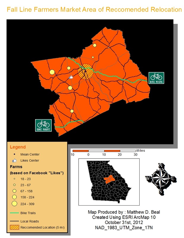
This was a map we did around Halloween (hence the color scheme), which was basically a practice test, if I recall correctly. It really panicked the whole class, and for good reason. Many of us had not grasped the basics, myself included, but things always work out in the end.
|
|
|
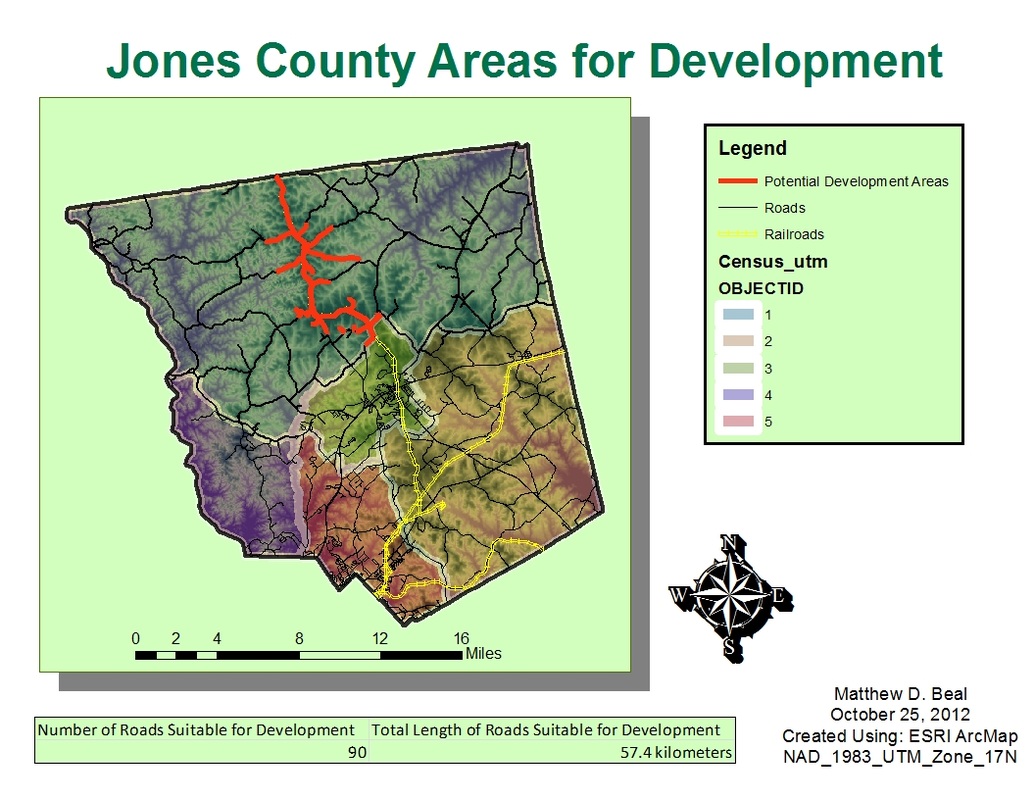
This map was our actual test. It isn't as fleshed out as many of my maps because I do not work well under pressure and we only had two hours to do this. So color schemes and visual appeal suffered, however, I don't think it came out too bad. It was a massive relief when I finished this map.
|
|
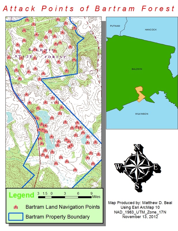
This is another map I threw together in a short time. I would later go on to use this data for my final project.
|
|
|
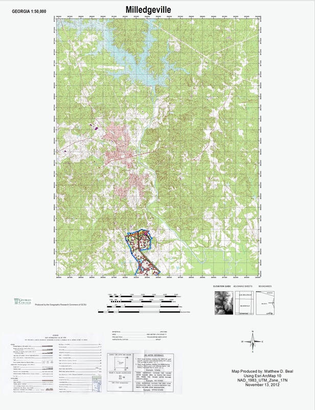
This is the final result of my project. My goal was to make it as close as possible to the specification of most topographic maps, which was quite difficult due to the lack of some resources. It is basically a topographic map of the quadrant that the Bartram navigation course is located on for use by instructors.
Here is the PowerPoint presentation explaining the detailed purposes and methods behind this map.
|
||
