Advanced Geographic Information Systems
I was possibly even more terrified of this class than I was for Intro to GIS. However, I would soon come to find out how much I had retained and was then able to apply that in a much more effective manner than I though. This class was still challenging, but now that I understood the basics of arcGIS, I felt I was able to create better maps, and just be all around more effective throughout the entire process.
|
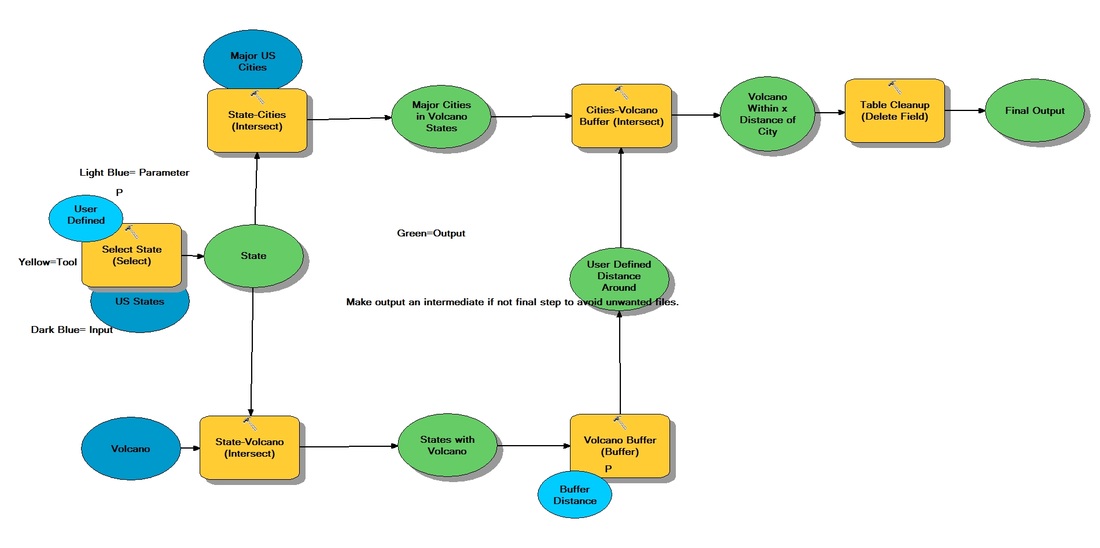
This lab was our first attempt at creating models, which are essentially tools. It is a series of commands that output useful information or perform beneficial actions. This is a very basic one that queries a state for volcanoes and then lets you know how many cities are in a user defined distance. It is essentially a tool used for determining the danger zone for volcanoes.
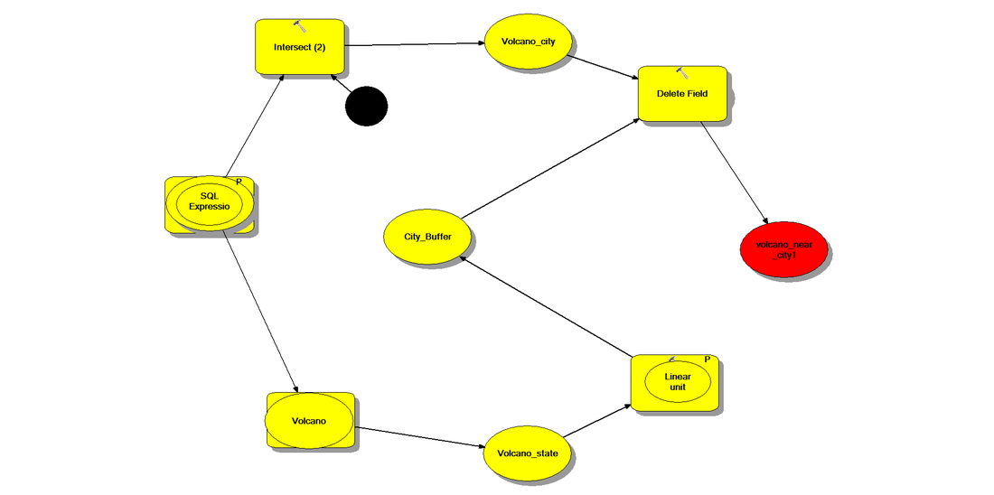
This image is the same tool just in the form of pacman. Why? I don't really know. I was bored one day and it amused me. |
|
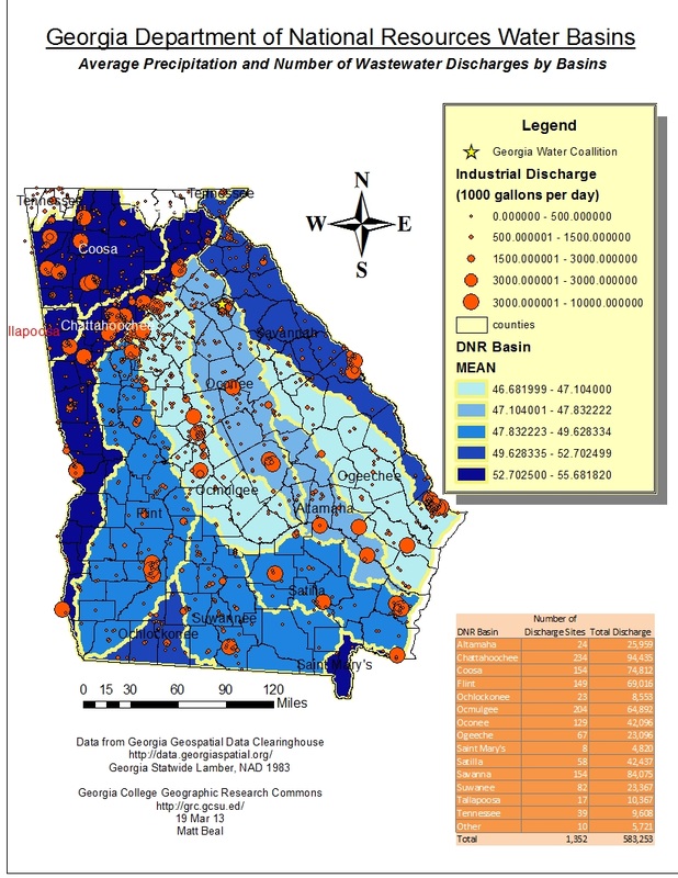
This was a map I made showing the average precipitation an waste-water discharge by the basin. This was quite a difficult map to make, but I am happy with how well it turned out.
|
|
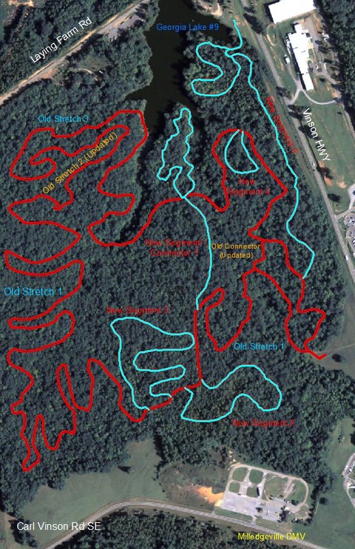
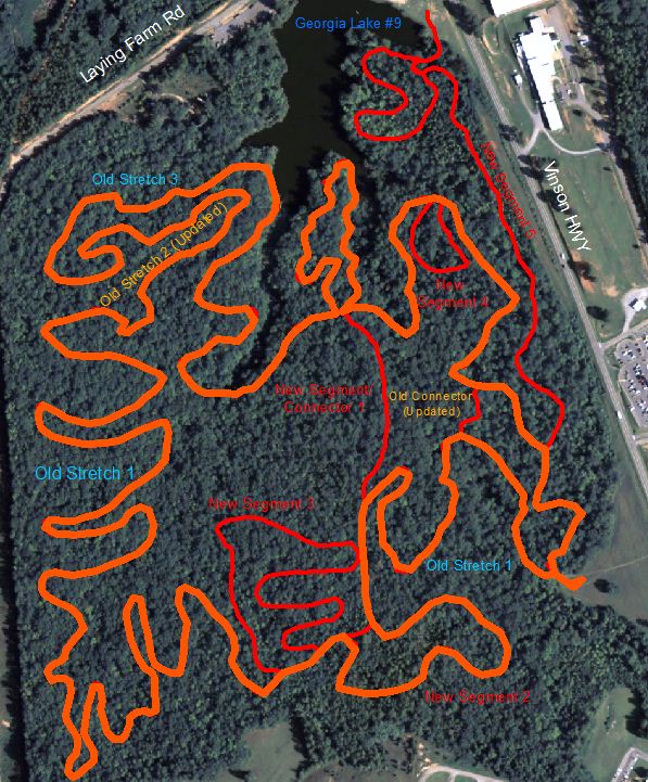
A lengthier trail with more difficult terrain.
|
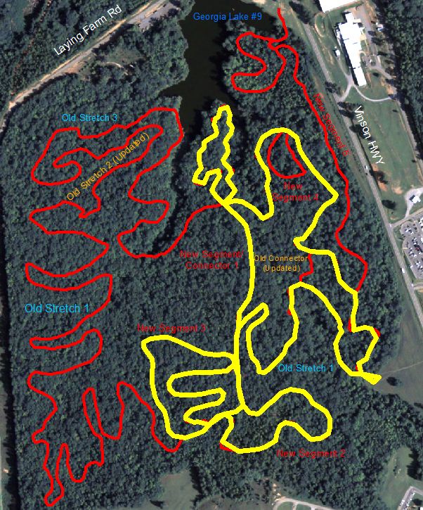
This is one of the several versions of the final product of my map. This map shows all the existing trails of the Selma-Irwin Bike trail in red, and proposed additions in blue. I made several others (below) for varying degrees of trail difficulty or rider experience.
A simple and short beginner course.
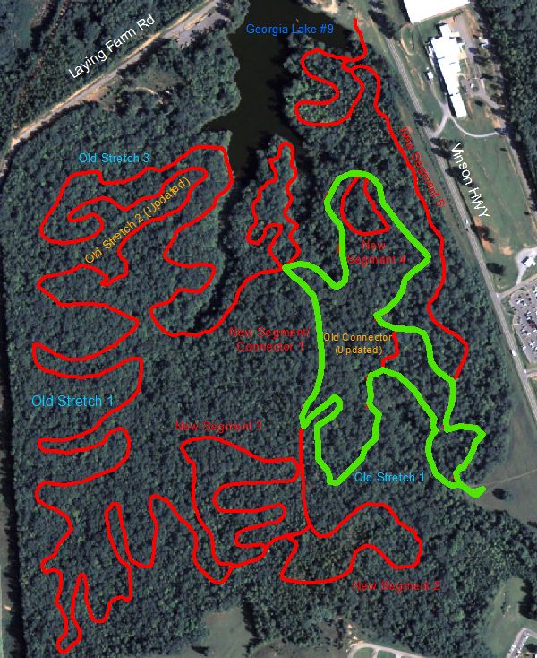
A trail for the true cycle enthusiast. Extremely long and difficult terrain.
|
|
This is the actual presentation that I prepared to properly showcase my project.
|
|
||
